Geospatial Big Data and the Use of Satellite Imagery
The ability to process and analyze big data is a breakthrough for the satellite imaging industry. Big data analysis is applied in many spheres of human activity and can be used both by government and small business participants.
Satellite and tech companies have significantly increased their offer for researchers in recent years. Thousands of researchers are using high-resolution data from commercial satellites and cloud computing resources to process datasets. Innovative technologies give researchers new, improved ways to monitor and visually capture the loss of forests and coral reefs and predict glacier melt and disease outbreaks. Technologies are also providing new ways to control and increase productivity in agriculture due to NDVI index calculation and other crucial data. The analyzed areas have never been so extensive; sometimes, the entire globe becomes the research object. Such studies are becoming the subject of global discussion and media coverage.
However, commercial data and cloud computing do not solve all of the researchers’ problems. The main task of commercial companies is to provide private clients and the government with high-quality images with high resolution while leading government space organizations to test spectral quality, taking into account certain types of scientific analysis. In addition, only the Landsat program provides free access to archives of the earth’s surface images for the past 50 years.
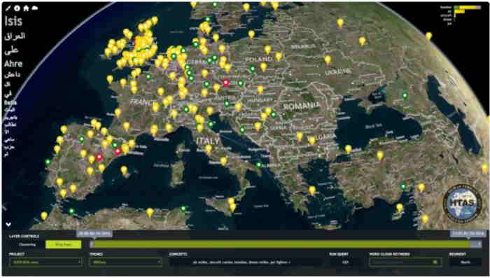
Data-driven Decisions for Government and Business
Farmers have to make countless decisions every year, and the more information they have, the more efficient and streamlined the process becomes. Big Ag data have driven rapid progress in precision farming as farmers and agribusinesses have access to resources to increase their yields.
Access to big data analytics and big data technologies has the potential to bring significant benefits to growers. Data collection is carried out by various sensors, including those used by farmers to measure soil moisture, yield, and other parameters. Hardware also includes imaging tools such as satellites and drones. They are crucial for capturing and displaying the health of the crops.
Today’s satellites are equipped with powerful sensor technology based on artificial intelligence and machine learning. So, the use of them is relevant not only for agriculture. Environmental organizations use up-to-date satellites to detect and eliminate wildfires. Due to the satellite images, the agencies also document ecological activity over time, including receding coastlines and the drying up of marshes. Tax authorities can determine the type of land use without visiting the site, and satellite technologies enable auditors to differ residential areas from farmlands. Transport services can assess the traffic situation due to the real-time satellite images.
Geospatial big data can be used in any field where you have to deal with data collection from a massive number of sources. It can provide helpful information to improve business-processes. As for the government, the use of data helps to react in time and make more effective and safer decisions for its citizens.
The Use of Satellite Images
The various satellite systems operating in earth orbit are called overhead space systems. They are an essential part of the digital infrastructure of private and governmental organizations. They have changed significantly in the latter with the development of artificial intelligence and machine learning applications. Space systems collect and transmit visual data much faster and more efficiently through applications.
Earth-orbiting satellites capture most of the space imagery today. Previously, heavier and more expensive equipment was used. In the 70s, images of our planet were taken by the German V-2 Rocket and the American Apollo 17. NASA made the first satellite photos using the suborbital spacecraft US Explorer 6. Nowadays, taking images from space has become much less labor-intensive and does not require so many resources. In addition, cameras have since then, and therefore the quality of photos has improved significantly.
However, taking high-quality images is not the only function of modern satellites. They are empowered with digital intelligence so that they can sort and analyze data. Artificial intelligence controls the sorting, and the camera is only focused on analyzing and targeting useful information. Satellites transmit images to the Earth’s surface for further processing to ground stations. After receiving data through ground stations, artificial intelligence programs on more powerful local computers sort, analyze, process, and prepare the data according to customer specifications.


